GCRI promotes collaboration from people across the world. To facilitate this collaboration, we have developed some simple tools to help keep track of time zones.
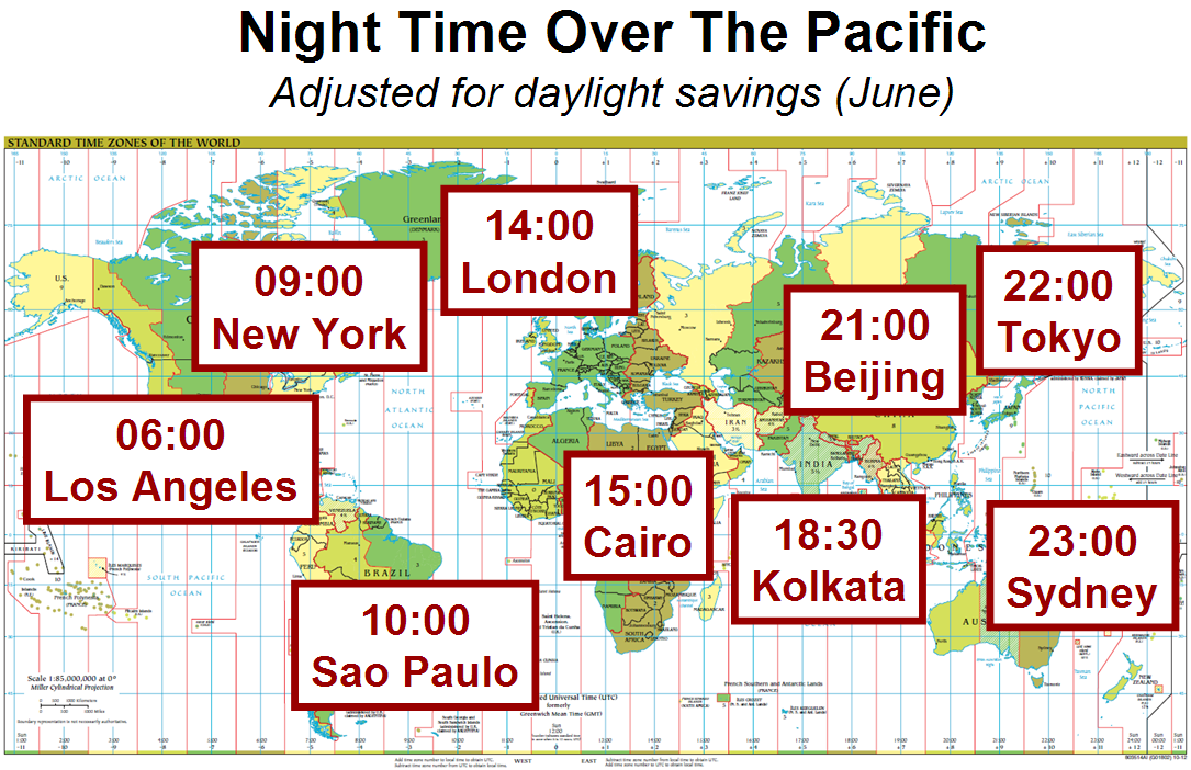
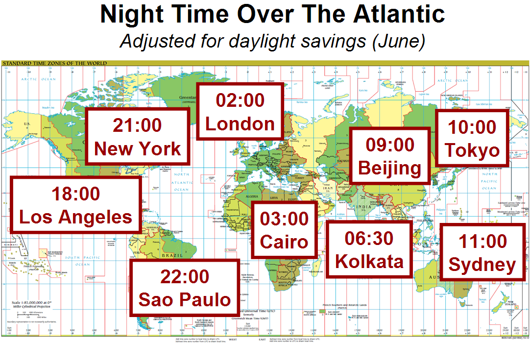
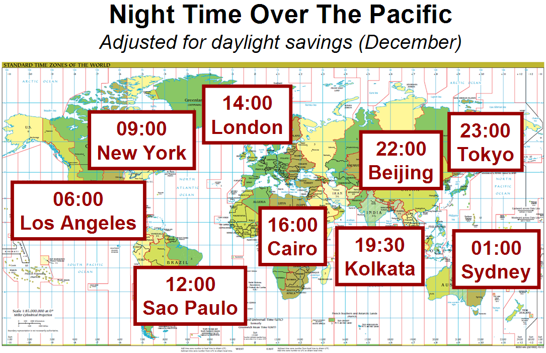
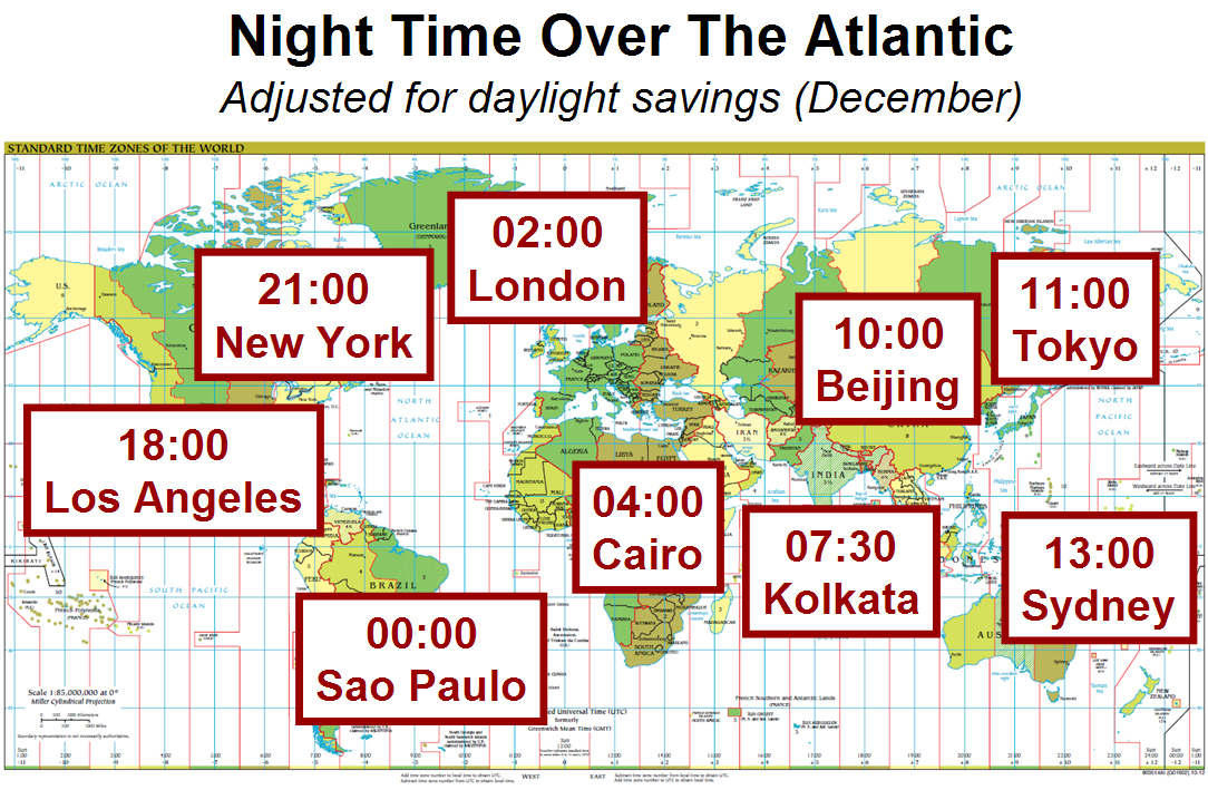
When scheduling across many time zones, it is often helpful to select times when it is night time over either the Atlantic or Pacific Ocean. Doing so can avoid forcing some participants to join at night time when they would normally be sleeping. In most cases, Pacific night will work best when there are participants from each of the Americas, Africa/Europe, and Asia/Australia. Atlantic night will work better when there are participants from the Americas and Asia/Australia.
The maps below show some major time zones at specific hours of the Atlantic and Pacific nights. Separate maps show June and December times, corresponding to daylight saving time in the Northern Hemisphere (June) and Southern Hemisphere (December). Click the maps to obtain larger versions. To obtain exact times in any time zone, we recommend services such as Time Zone Converter. All maps are accurate as of 20 December 2012; note that daylight saving time in specific regions can change via political decisions.
Finally, here is a map showing when daylight saving times begin and end at select regions. Many regions have complicated daylight saving schemes and need to be checked on a place-by-place basis. For these regions, we recommend consulting a reference such as Wikipedia’s Daylight saving time by country page or WorldTimeZone.comm.

Sources: The time zone maps were made using the CIA’s world time zone map. The daylight saving map was made using DST Countries Map by TimeZonesBoy from Wikimedia Commons.
Licensing: All of the images on this page are licensed under a Creative Commons Attribution-NonCommercial-ShareAlike 3.0 Unported License.


